Phoenix Valley Metro, South Central Light Rail Extension

As part of the Valley Metro’s team, T2 Utility Engineers provides survey and mapping services, along with completing Subsurface Utility Engineering services utilizing the ASCE 38-02 Standards.

As a member of the program management team, T2ue was selected as a Utility Engineer for the project which involves providing underground utility locating/mapping services, as a sub-consultant to HDR on this project to Valley Metro’s team. This project included survey and mapping services, along with completing Subsurface Utility Engineering (SUE) services utilizing the ASCE 38-02 Standard for mapping subsurface utilities.

Phase One of the project included the Central corridor for the proposed LRT encompassing over five (5) miles of roadway in Central Phoenix from Baseline Road to Washington Street in down town Phoenix. Phase Two of the project, included both 7th Street and 7th Avenue and I-17 interchanges, Washington and Jefferson Streets from 3rd Ave to 1st Street, and finally 3rd Ave and 5th Street segments affected by the overall design.

Underground Utility Investigation before image Underground Utility Investigation after image showing marked utilities

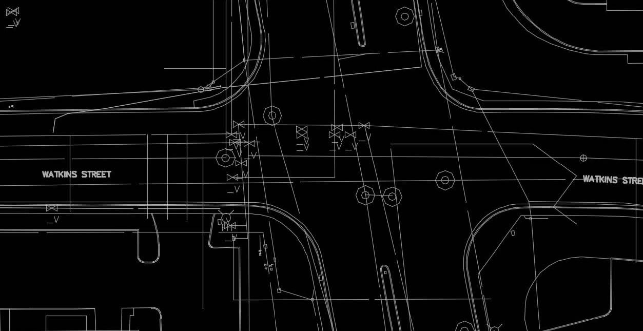
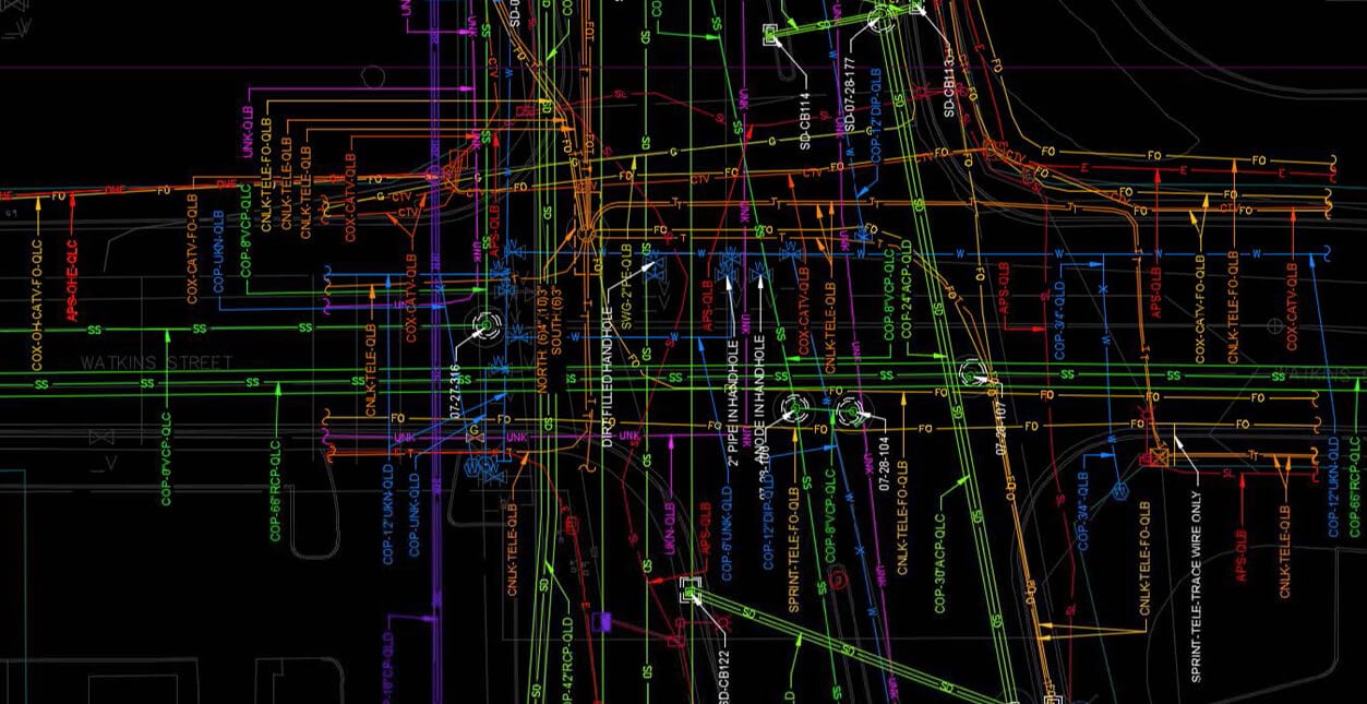
Left shows original QLD records: Right shows additional utilities found by T2ue investigation QLB. Our investigation found 82% more utilities, 2 miles of unknown utilities, and eliminated the need for 2800 test holes saving the client $3,000,000.

T2ue provided Subsurface Utility Engineering services, utilizing the CI/ASCE 38-02 standard, including conducting records research (CI/ASCE 38-02 Quality Level D), field observations (CI/ASCE 38-02 Quality Level C), designating utilizing geophysical equipment to horizontally position the subsurface utilities (CI/ASCE 38-02 Quality Level B), structure reviews/diagrams (for all subsurface utility structures), Utility Coordination, and providing this information to the client via CAD drawings. The ASCE 38-02 Plan was signed and sealed by a professional engineer. The preliminary design team completed a utility base map of just record information for the 15% plans, this utility base map included roughly 308,000 LF of utilities.

Once the field investigation and ASCE 38-02 process was completed for Phase One, T2ue mapped 555,015 LF of utilities. This included over 125 unknown utilities that stretched out over two (2) miles in footage. Following the ASCE 38 Standard, the T2ue team mapped over 80% more utilities than on record, and this advanced investigation will aid the CMAR team to build a faster, cheaper, and most importantly, a safer project for the City and Valley Metro. The overall mapping between Phase 1 and Phase 2, T2ue mapped over 700,000 LF. This project also included utility coordination with the CMAR team, Valley Metro, HDR, City of Phoenix, 3rd party utility companies and T2 Utility Engineers.

Client:

BA, Inc.

Project Owner:

Valley Metro Regional Public Transportation Authority

City:

Phoenix

State:

Arizona

Country:

USA

Recent news

What Our Clients Are Saying

“T2ue completed the Subsurface Utility base-map and investigation for Valley Metro’s Northwest Phase II CMAR project. T2ue’s work exceeded Jacobs’ and Valley Metro’s expectations, and proved to be more thorough and accurate than previous preliminary utility locating services used by Valley Metro. The level of detail provided by T2ue started the project on the right path, giving the final design team confidence in the base utility mapping. T2 Utility Engineer’s involvement on this project undoubtedly helped the team maintain the project schedule, and allowed the Construction Manager at Risk to more quickly and accurately zero in on the utility quantities and costs.”

Vice President & Manager of Projects, Jacobs

Andrew Haines, PE

Related Projects

Stay up to date with T2ue and follow T2 Utility Engineers on LinkedIn.